Hi there!
Here an article about how I am organising my next trip to Uganda: the best “waypoints”, the choice of the guide, the necessary gear and accessories, the safety measures and precautions and the important creation and develop of a trip plan.
Once again, mother Africa is calling me back with its gravel voice and its smell of ad-venturous experiences I can’t stop thinking about. This time, it led me to the place where you can have unforgettable interactions with the wild, where mountains soar, the place of amazing terraced hilltops; it’s home to Africa’s tallest mountain range (the Rwenzoris), the source of the Nile, the world’s longest river and the continent’s largest lake. One of the last places in the world (with Rwanda and D.R. Congo) where it’s still possible to track mountain gorillas in their misty habitat.
With a tapestry of landscapes, excellent wildlife watching and welcoming locals, Uganda packs a lot into one small country.
Uganda gained independence from Britain in 1962. The period since then has been marked by intermittent conflicts, including a lengthy civil war against the Lord’s Resistance Army in the Northern Region, which has caused hundreds of thousands of casualties.
Nowadays, the country with its people is raising its head trying to climb the economy growth ladder and actually positioning 24th over 54 african countries.
What to do and where to go: can’t-miss waypoints
To begin, I just want to be clear in saying that, for security reasons, I’m not gonna publish the dates I’ll be travelling to Uganda and the order of the waypoints is not the same I’ll follow.
TIP -> …when you go for a trip, especially in “wild” or “difficult” countries, don’t advertise it too much, especially the dates. Internet is wilder than the wild: for sure, is worst. You don’t wanna communicate when your home will be empty for days, when you arrive and where you stay with your brand new photography set and, normally for a tourist (not for a traveller), a bunch of money you saved maybe all year long.. Low-profile is the key.
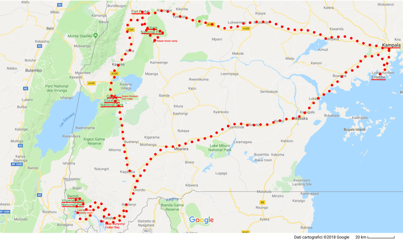
The main route I developed throughout the south of Uganda
1st Waypoint: Entebbe
Entebbe, Uganda’s largest commercial and military airport, is probably the first ground you’ll step on in a trip to this country. With about 70.000 inhabitants and located on a Lake Victoria peninsula at an altitude of approx 1.200mt asl, is a major town in central Uganda and just approx. 37 kilometres southwest of the capital Kampala.
I like to travel light and move fast so I’ll spend the first night here in a “budget b&b” where I’ve been able to get a single room (with a bathroom in it) for about 30€ per night. Best way to find a place to stay is still by doing a cross research on booking.com (if you go through this link you get a 15€ discount on your next reservation) and tripadvisor taking a look at the normally useful reviews.
A nice and cheap hotel it’s the ViaVia Entebbe, it worth the value!
A glimpse over Entebbe
My flight will arrive at about 01:00pm so, after having fixed my accomodation, I’ll spend the afternoon visiting a bit the city and..
TIP-> …buying a local sim card with some data bundle package on it. It is important, if you plan a wild trip, to be wild in experiencing and living the place but always focused and systematic in avoiding any possible unplanned situation with nothing left to chance. Having a local sim card can get you out fast of many problems and lets your closest peaceful by having news..all for about 10/20€.
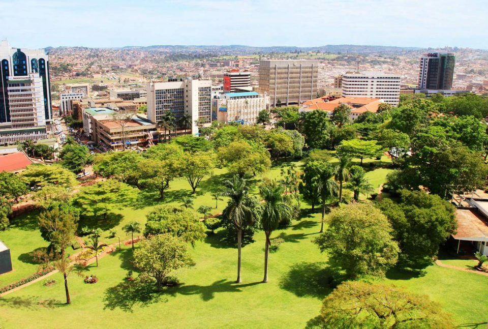
2nd Waypoint: Kampala
Kampala, the capital and largest city of Uganda. Located at about 1.200mt asl, it has approx. 2.500.000 inhabitants.
Sure, traffic in the center is a problem, and the city may not score as highly as other cities on infrastructure, but it’s cheap, friendly, relatively safe, diverse—and it has some serious party chops. It worths a view.
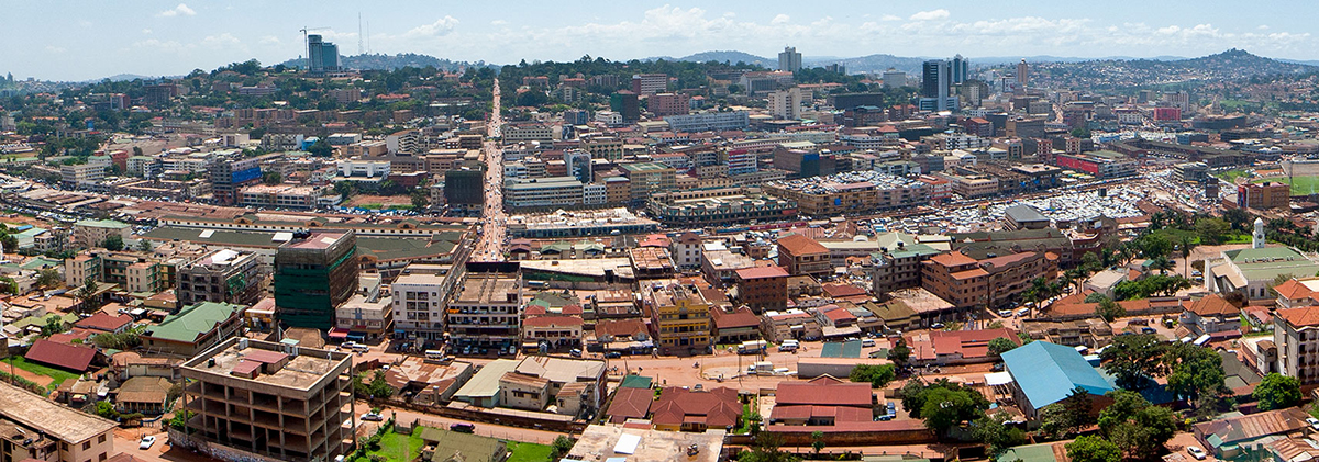
Kampala from old mosque
I’ll spend one day around Kampala to take a look at the city and to some of the major “key-points”: the Baha’i temple, Brave Owino market, the Old Taxi park and probably a taxi-Matatu ride to Jinja which may take two to three hours journey up to Jinja, the source of River Nile.
3rd Waypoint: Kibale Forest via Fort Portal
After about 6 hours driving, I’ll take a stop to Fort Portal first. The drive from Entebbe to Kibale is incredibly scenic, passing through tea plantations and the lush green countryside which characterizes so much of Uganda.
Fort Portal, heartland of a verdant tea-growing area, has about 54.000 inhabitants and is located at an elevation of about 1.500mt asl: the fort may be gone, but this dynamic and friendly town is definitely still a great portal to numerous places offering sublime scenery, amazing nature and genuine adventure. Here you can explore the beautiful Crater Lakes, track the chimps in Kibale Forest National Park or drop into Semuliki National Park with its hot springs and central African wildlife.
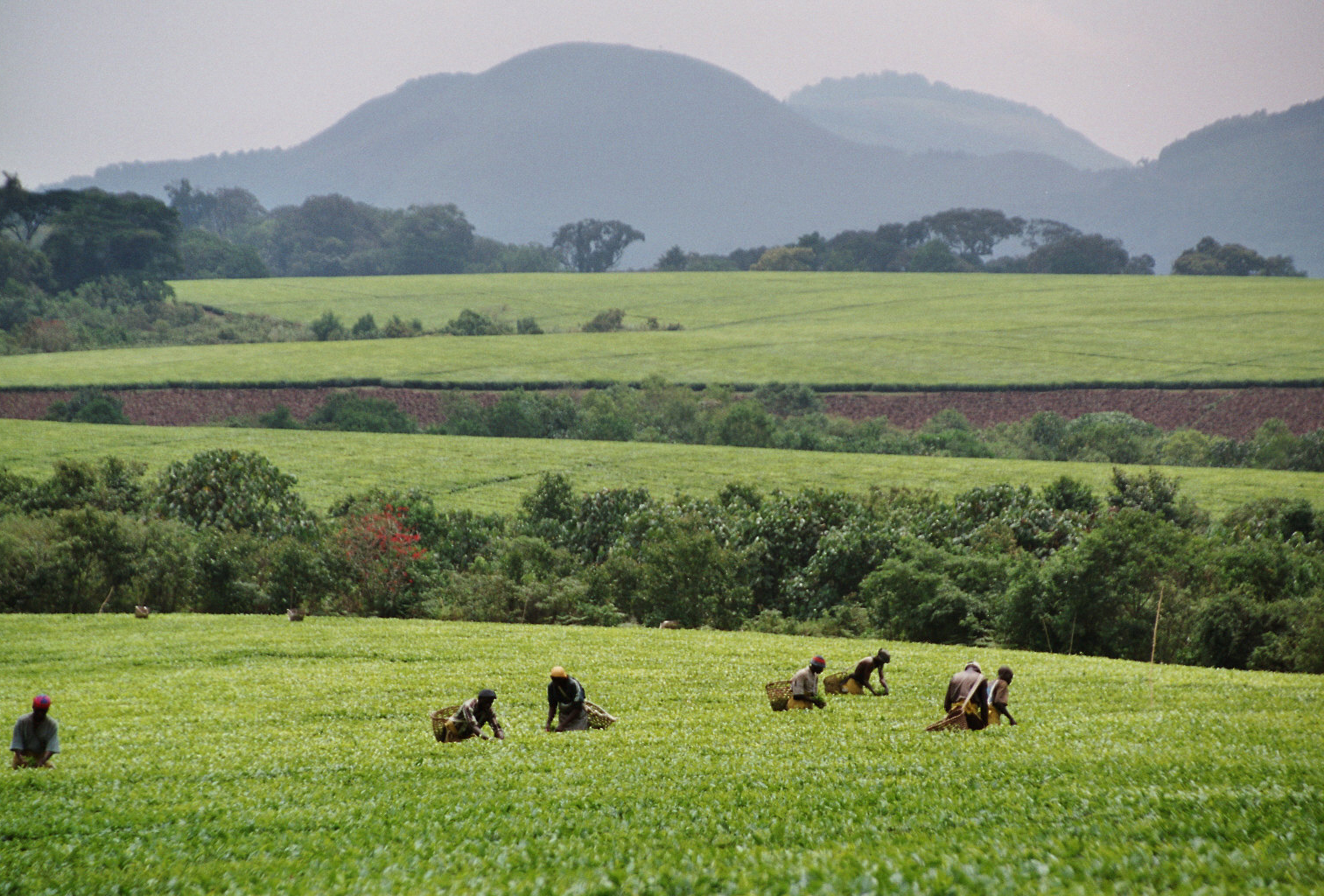
The lush green tea plantations with all its magic
After a stop in Fort Portal, straight to the daily destination: Kibale Forest National Park.
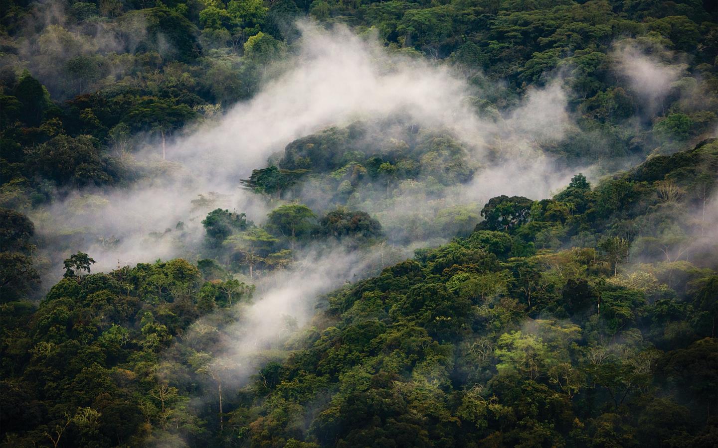
Kibale Forest is a natural park protecting moist evergreen rain forest. It is 766 square kilometres in size and is located between 1.100 metres to 1.600 metres in elevation. Despite encompassing primarily moist evergreen forest, it contains a diverse array of landscapes and is one of the last remaining expanses to contain both lowland and montane forests. In eastern Africa, it sustains the last significant expanse of pre-montane forest.
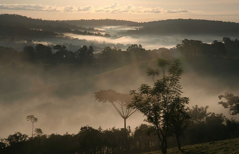
A magnific sunrise shot throughout Kibale Forest
The park boasts 325 sited species of birds, as well as red and blue duikers, bushbucks, sitatungas, bushpigs, giant forest hogs, common warthogs, and African buffalo. The carnivores that are present include leopards, African golden cats, servals, different mongooses, two species of otter and lions which visit the park on occasion.
Besides this, Kibale forest is mainly popular due to the presence of 13 species of primates, between which the Chimpanzee; many of them persist in the less disturbed areas of the forest in their natural habitats. Kibale Forest National Park boasts the highest number of primate species in the world. Approximately 5.000 chimpanzees live in the wild in Uganda, which makes it a perfect place to spot them!
In the early morning I’ll move with a ranger for chimpanzee tracking, hoping to catch up with other monkey species as well. A swamp walk of about 4-5 hours will take me through grassland, small communities and some beautiful scenery, where the locals are likely to give big welcomes. Here is where I’ll spend the entire day, mainly hiking throughout the forest to enjoy this precious wild nature.
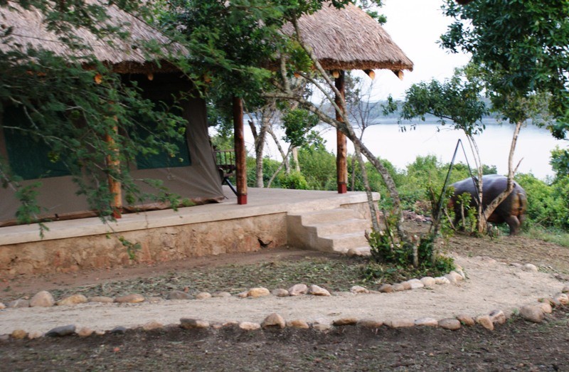
When the sun goes down, better have a place to stay because “the wild wakes up“. Here around there are a few places but if you wanna fully live this experience, you can’t miss a lazy camping in the forest. From the first time I slept in the wild, actually in the Tsavo East Park, I consider those nights as the best television, radio, hi-fi -ever-! A taste of it can be managed through the Kibale Forest Camp.
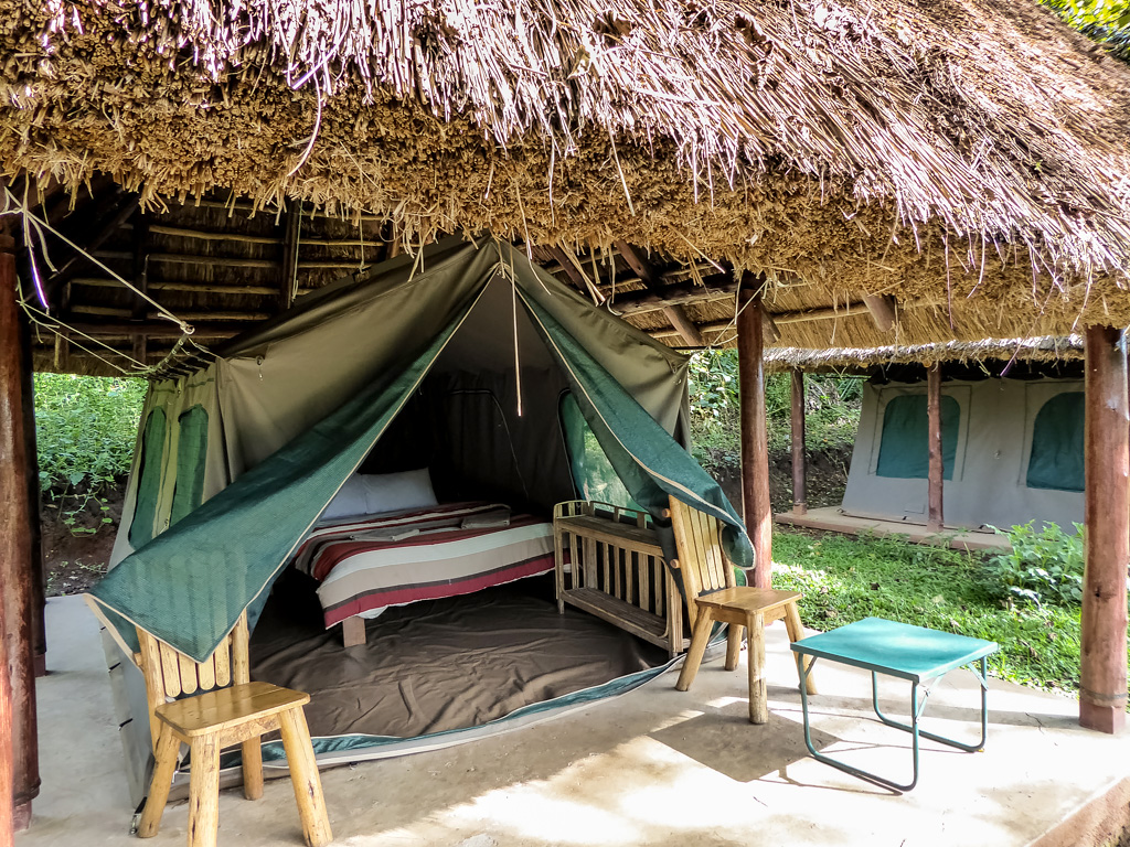
A classic “safari tent” for a real deal lazy camping experience
4th Waypoint: Queen Elizabeth National Park
Queen Elizabeth National Park is Uganda’s most visited national park and the second largest one, located at the base of the majestic Rwenzori Mountain range and adjacent to Lake Edward and Lake George.
It occupies an estimated 2.000 square kilometres area and is well known for its wildlife, including African buffalo, Ugandan kob, hippopotamus, Nile crocodile, African bush elephant, African leopard, lion, and chimpanzee. It is home to 95 mammal species and over 500 bird species. The area around Ishasha in Rukungiri District is famous for its tree-climbing lions, whose males sport black manes. Poachers killed six elephants in the park in 2015, triggering both anger and frustration within the Ugandan conservation community.
The park is also famous for its volcanic features, including volcanic cones and deep craters, many with crater lakes, such as the Katwe craters, from which salt is extracted.
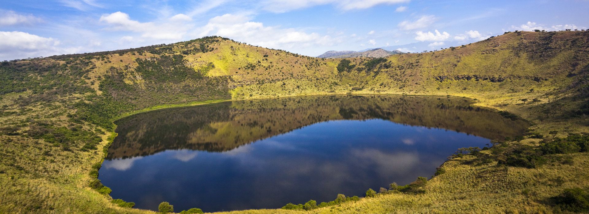
Speechless view of the crater
I’ll spend a couple of days hiking around the park tracking and spotting the wildlife and taking a boat to ride along the Kazinga Channel which joins Lake George and Lake Albert. Here, I’ll be more close to see a lot of hippos as well as a variety of other animals which come to the waterhole to drink or bathe such as buffalo, crocodile, bathing elephant.. This will undoubtedly be one of the highlights of my trip.
When the sun goes down, yet again is time to find cover.. Same as Kibale, if you wanna go wild you can manage to have a lazy camping, i.e., through the Queen Elizabeth Bush Lodge. Remember:
TIP ->…even if, I know, it’s not easy to realize to be in the real wild..there you are. So when the night comes, is highly suggested to not go out of your tent if not for a concrete and important reason and, even in this case, I suggest to call someone who can help you out.
As great as dangerous, remember you are the guest in the wild..
5th Waypoint: Mweya Peninsular
The Mweya Peninsula is located on the northern bank of the impressive Kazinga Channel at the convergence of the channel with Lake Edward; here you can enjoy splendid views over the water with sights stretching all through to the Rwenzori Mountains. The Mweya is among the finest places to spot lions and leopard, which normally live within the scrubby thickets. And that’s why is gonna be my 5th can’t-miss waypoint!
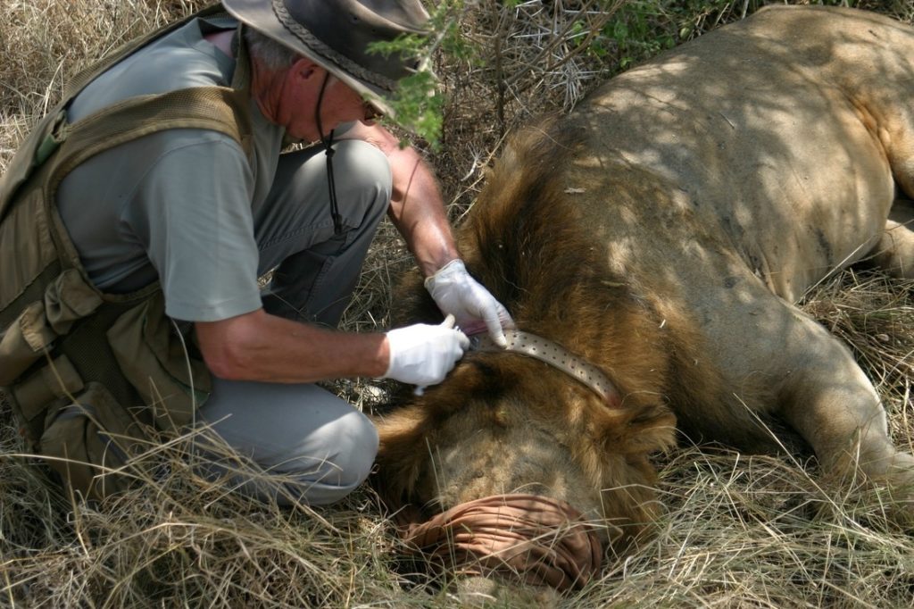
Collars are essential for monitoring each populations of lions
I will actively participate in monitoring some of the lions in the park, early in the morning and at night, using locator devices and learn habituation calls, as well as monitoring weather, surroundings and behavior. The results are added to researchers’ databases, contributing valuable information to the overall understanding of wildlife ecology – and helping to conserve this wonderful ecosystem through the help of The Carnivore Program.
Some of the park's conservation challenges and what Uganda Carnivore Program is doing to address them
6th Waypoint: Lake Bunyonyi
Lake Bunyonyi, also called “the lake of the little birds“, is close to the border with Rwanda and located at an elevation of almost 2.000mt. Its contorted shore encircles 29 islands, surrounded by steep terraced hillsides. A magical place, especially with a morning mist rising off the placid waters, it has supplanted the Ssese Islands as the place for travellers to chill out on their way through Uganda, and has a selection of gorgeously remote and bucolic places to stay on distant islands, where you’ve only the birds for company. Best of all – unlike many lakes in East Africa – Bunyoni is bilharzia, croc and hippo free, and so its crystal-clear waters are all yours to swim in and canoeing!
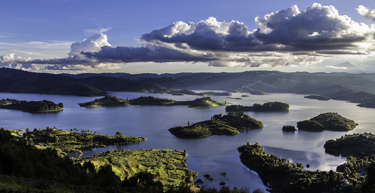
A stunning view of the lake by Helen Suk. Click on the image to visit her blog
Night time, same rules.. Here, the best way to get a comfortable “budget” accomodation is to go through the Crater Bay Cottages, a wonderful place to relax, explore and enjoy the spectacular landscape and beauty that is portrayed before you as Lake Bunyonyi.
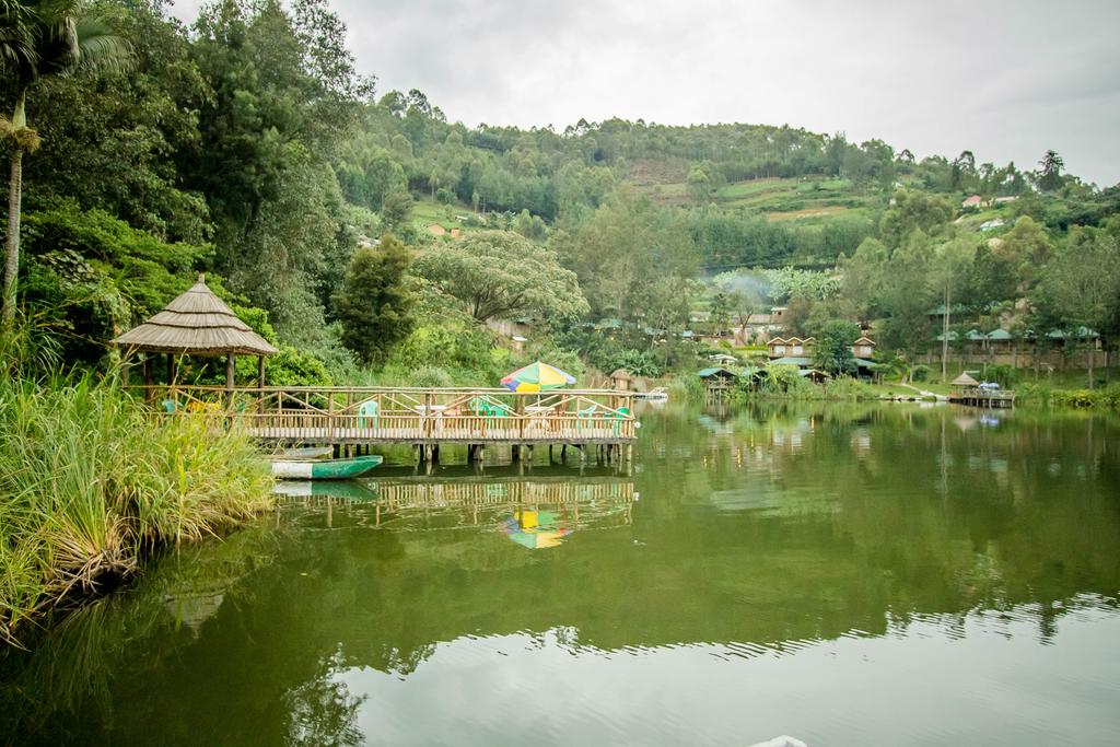
The Crater Bay Lodges
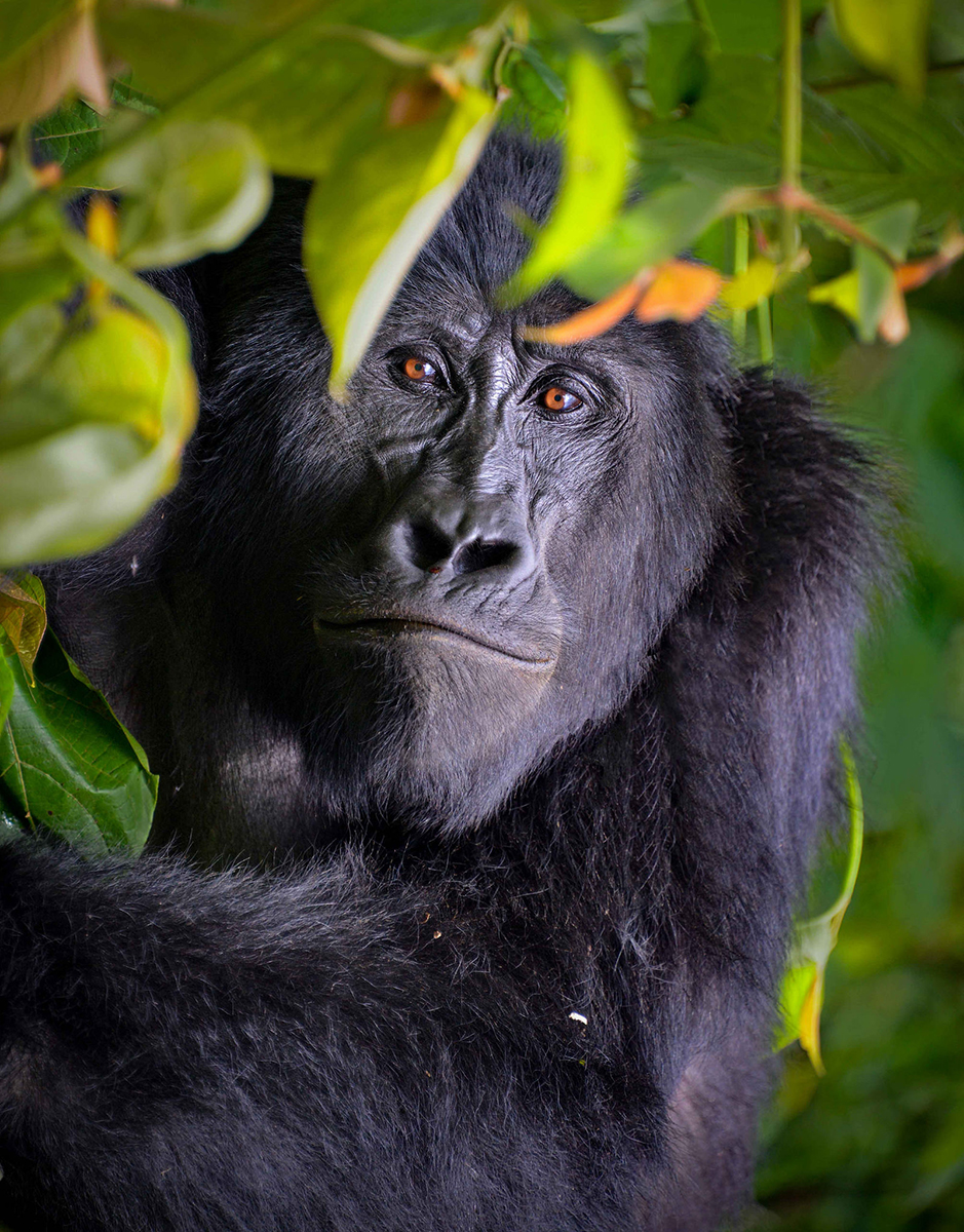
7th Waypoint: Bwindi Impenetrable Forest – Gorilla Tracking
Yes.. Mountain Gorilla tracking.. one of the best experience you can have in your whole life and God knows for how long..
Mountains Gorillas, Uganda’s gentle giants, are divided in two populations: one is found in the Virunga volcanic mountains of Central Africa (D.R. Congo) and the other is found in Uganda’s Bwindi Impenetrable National Park. Conservation efforts have led to an increase in overall population of the mountain gorilla (Gorilla beringei beringei) in the Virungas and at Bwindi. The overall population is now believed to be at least 880 individuals (as of Sept 2006). Three more – infants who suffered a traumatic poaching experience, injuries from snares, and/or losing their mothers in brutal killings – are currently in care of the Senkwekwe Centre orphanage in the D.R. of Congo.
Despite their recent population growth, the mountain gorilla remains threatened. As of 2008, mountain gorillas were listed as Critically Endangered on the IUCN Red List and are dependent on conservation efforts to survive.
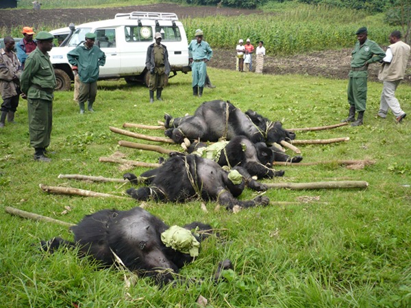
Gorillas brutally killed by the poachers
Mountain gorillas are not usually hunted for bushmeat, but they are frequently maimed or killed by traps and snares intended for other animals. They have been killed for their heads, hands, and feet, which are sold to collectors. Infants are sold to zoos, researchers, and people who want them as pets. The abduction of infants generally involves the loss of at least one adult, as members of a group will fight to the death to protect their young. With young gorillas worth from $1000 to $5000 on the black market, poachers seeking infant and juvenile specimens will kill and wound other members of the group in the process..or whoever in the middle, even people.
Bwindi Impenetrable forest is a large primeval forest located at elevations ranging from about 1.200 to 2.600 metres. “Bwindi” is derived from the Runyakitara language and means itself “impenetrable“. This name comes from the extensive stands of bamboo interspersed amongst the larger forest hardwoods. Bamboo and thick ground cover of ferns, vines, and other plant growth severely hinder direct access on foot.
Also known as the “Place of Darkness”, the forest is on the edge of the western arm of the Great Rift Valley, only a few kilometers from the Democratic Republic of the Congo (DRC) border and about 25 kilometres north of the Virunga Mountains
En route, with my guide we’ll point out signs of previous gorilla activity, including dung, nests and chewed bamboo shoots. The track will be an exciting journey along forested slopes, entwined vines, bushes and bamboo before we eventually reach the gorilla family.
The time taken to track the gorillas can be as few as 2-3 hours to as many as 7-8 hours. Once the gorillas have been located, we will spend about a hour with them. Coming face-to-face with a mountain gorilla is a truly humbling and emotional experience. This is a fantastic and privileged opportunity to get up close and personal with Uganda’s very own ‘Gorillas in the Mist’.
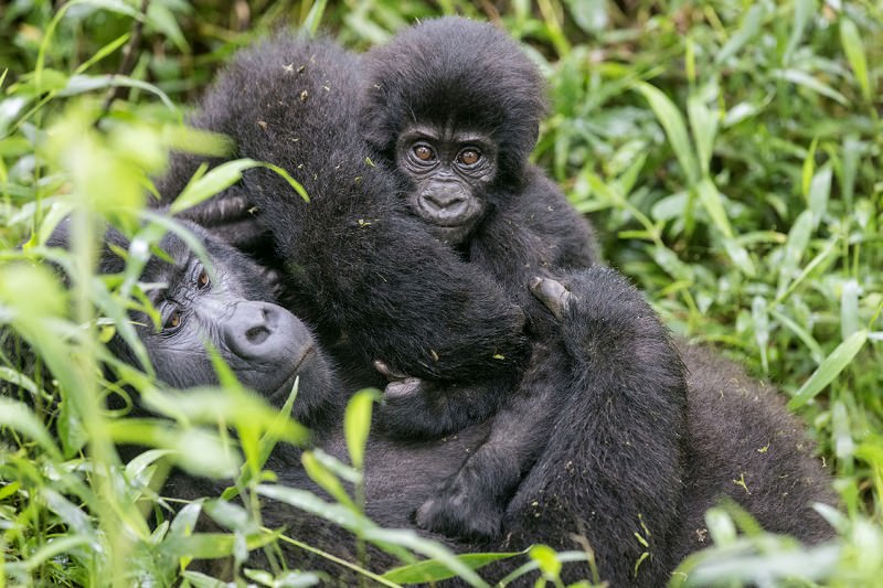
A deeply tender gorilla baby with his mom..
Over night, worth a stay in one of the places situated around the Mutanda Lake. A good option to keep a healthy “wild” level is, i.e., the Mutanda Lake Resort. Like their home page says: “perched on a Lake Mutanda peninsula in the shadow of the Virunga Mountains, the resort offers comfortable accommodation combined with the most beautiful views on planet earth. It is a perfect base for gorilla trackers, lake loungers, volcano hikers, bird lovers as well as those looking for a mystical place in nature.” So why not to trust in it?!
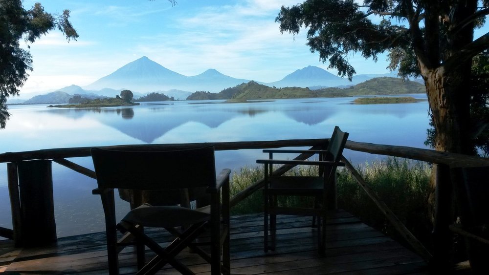
A truly relaxing view from one of the accomodations..
Xth Waypoint: in process…
As usual, I managed to have a couple of free jolly days that I can use to extend some of the already planned waypoints in case any hyper-interesting activity comes out on-field or that I get some hints from the local people to enjoy even more a wild and local experience.
What do you need to go to Uganda?
Money aside… you need:
- your passport valid for a minimum period of 6 months from the date of entry into Uganda
- an entry visa: apply online for an ‘e-visa’. It’s fairly fast (about 2-4 days) and it costs about 50 us dollars
- a yellow fever certificate: it has to be done at least one month before the departure and it’s mandatory
Packing up for a wild trip to Uganda?
Wanna know about what to bring to a trip like this that can fits a 50lt backpack? Clothes, shoes, safety accessories, technology and photography gear…
Stay tuned for the next article incoming…!
Follow the blog by clicking the mail icon here at the bottom and don’t forget to follow me even on instagram for a daily doses of travels and wild!